Winter weather hazards
Environment and Climate Change Canada defines these winter weather hazards:
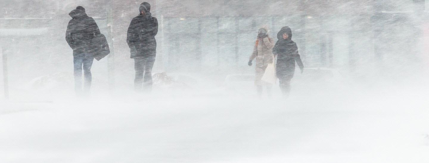
Blizzard. Strong winds combine with heavy or blowing snow, limiting visibility.
Freezing rain and ice pellets. Freezing rain is liquid precipitation that freezes on contact with objects at sub-freezing temperatures, such as cars and power lines, forming an ice layer. Ice pellets form when raindrops fall through sub-freezing air, freezing the raindrops before they reach the ground.
Ice fog. At extremely cold temperatures — usually colder than -30°C — ice crystals suspended in the air can form a fog that reduces visibility.
Rain. In winter, rain falling on frozen surfaces increases runoff and can cause flooding.
Smog. In winter, fine airborne particles of wood smoke, vehicle exhaust and road salt can form a smog when there's not enough wind to disperse the particles. The smog degrades the air quality and can be a health hazard.
Snow. Snow is precipitation in the form of ice crystals. Snow is possible anywhere in Canada, with the Rockies and Gulf of St. Lawrence receiving the most and the west coast the least. More than a third of Canada's precipitation is snow.
Wind chill and cold temperatures. Wind makes cold temperatures seem colder, creating the effect called wind chill. Read more about wind chill below.
Winter storm. Winter storms form where air masses that differ in temperature or moisture content collide. Storm systems usually move from west to east and affect an area that's hundreds of kilometers wide.
Canada's winter weather alerts
Environment and Climate Change Canada issues four types of winter alerts:
- Warning. This most-urgent alert means that severe winter weather is occurring or imminent.
- Watch. Severe winter weather is likely, based on the current conditions.
- Advisory. Less severe winter weather — such as blowing snow, freezing drizzle or frost — is possible.
- Special weather statement. This least-urgent alert means that unusual weather conditions could lead to winter weather not covered by watches, warnings or advisories.
For some types of winter weather, the conditions that trigger an alert vary by location. For example, an extreme cold warning in southcentral and southwestern Ontario means the temperature or wind chill is expected to reach -30°C for at least two hours. In northern Quebec, it means the temperature or wind chill is expected to reach -48°C for at least two hours.
The types of winter weather for which Environment and Climate Change Canada has established public weather alert criteria include:
- Arctic outflow
- Blizzard
- Blowing snow
- Extreme cold
- Flash freeze
- Freezing drizzle
- Freezing rain
- Frost
- Snowfall
- Snow squall
- Winter storm
The Canadian wind chill index
On a windy winter day, we lose body heat faster than on a still day, and our exposed skin perceives the outdoor temperature as lower than it actually is. The perceived temperature is called the wind chill. Not only do we feel colder, but we're at greater risk for frostbite and hypothermia.
The following is the Canadian government's breakdown of wind chill hazards and precautions to take when outdoors.
Wind chill hazards and what to do
| 0 to -9 |
Low. |
Slight discomfort. |
- Wear warm clothing.
- Stay dry.
|
| -10 to -27 |
Moderate. |
Risk of frostbite and hypothermia if outside for long periods without adequate clothing or shelter from wind. |
- Wear layers of warm clothing and a wind-resistant outer layer.
- Cover your head, hands and neck, and wear insulated, waterproof footwear.
- Stay dry.
- Be active.
|
| -28 to -39 |
High.
Exposed skin can freeze in 10 to 30 minutes. |
High risk of frostbite and hypothermia if outside for long periods without adequate clothing or shelter from wind. |
In addition to the precautions for moderate risk, cover your face. Check face and extremities for numbness or whiteness. |
| -40 to -47 |
Very high.
Exposed skin can freeze in 5 to 10 minutes. |
Very high risk of frostbite and hypothermia if outside for long periods without adequate clothing or shelter from wind. |
Take the same precautions as for high risk. |
| -48 to -54 |
Severe.
Exposed skin can freeze in 2 to 5 minutes. |
Severe risk of frostbite and hypothermia if outside for long periods without adequate clothing or shelter from wind. |
In addition to the precautions for high risk, be prepared to cut short or cancel outdoor activities. |
| -55 and colder |
Extreme.
Exposed skin can freeze in less than 2 minutes. |
Extreme risk of frostbite and hypothermia. |
Stay indoors. |
Resources for winter storm preparedness
Bookmark these recommended information sources to help prepare for and recover from a winter storm. These resources aren't affiliated with Gallagher.
Winter storm resources
Disaster resources